top of page

Accurate, Reliable Land Surveying in Rutherfordton & Surrounding Areas

With 26 years of experience, we deliver clear and precise property surveys you can trust.

Licensed in North Carolina

Fast, Friendly Service

Residential & Commercial Surveys

SCROLL DOWN
Frame (3).png
Frame 1948754959.png
Frame 1948755041.png

Your Local Land
Surveying Expert

I’m Mark Horne, a lifelong North Carolinian and experienced land surveyor. I specialize in helping homeowners, builders, and real estate professionals protect and maximize their property investments.


From boundary surveys to construction staking, I provide personal service, fast turnaround times, and clear communication every step of the way.

  • Serving Rutherfordton and neighboring counties

  • North Carolina Licensed Professional Land Surveyor

  • Dedicated to precision and client satisfaction

Frame 1948754946.png

26+

Years In Professional Land Surveying

Frame (5).png

1,000+

Surveys Completed Across Rutherford & Surrounding Counties

Frame (6).png

100%

Local – Owned & Operated

Group 2.png

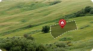
We Help You Make Property Decisions with Confidence

Whether you’re buying, building, or selling — the right survey protects your investment. Here’s how we help:

Boundary Surveys

Our boundary surveys precisely define the legal property lines of a parcel of land. Whether you’re buying, selling, or developing, we provide clear, reliable documentation of your property’s exact boundaries to avoid disputes and ensure peace of mind.

image (31).png

Property Corner Staking

Know exactly where your property begins and ends. We’ll locate and clearly mark your property corners with durable stakes, helping you prevent boundary issues and confidently plan for fencing, additions, or land improvements.

image (34).png

Elevation Certificates

If your property is in a flood-prone area, an elevation certificate is essential for insurance and regulatory compliance. We’ll provide accurate elevation data for your structure, helping you meet FEMA and local requirements while potentially reducing flood insurance costs.

image (32).png

Tree & Topographic Surveys

This survey maps the natural and man-made features of your land, including trees, elevations, structures, and utilities. Ideal for construction, landscaping, or property planning, our topographic surveys deliver detailed site data for informed decision-making.

image (33).png

As-Built Surveys

Our as-built surveys document the exact location of structures and improvements after construction is complete. These surveys verify that your project meets design plans, local regulations, and property boundaries — a vital step for builders, homeowners, and property managers.

image (35).png

Closing Surveys

A closing survey provides a clear, current view of a property’s boundaries and improvements for real estate transactions. It ensures that buyers, sellers, and lenders have accurate property information before finalizing a sale.

image (36).png

New Addition Surveys

Planning to add a garage, room, or other structure to your property? A new addition survey confirms property lines, setbacks, and existing structures, ensuring your project stays within legal limits and avoids costly disputes.

Garden-Room-Planning-Permission-Guide.webp

Whether you’re buying, building, or selling — the right survey protects your investment. Here’s how we help:

SAMPLE SURVEY.jpg
Group 1 (1).jpg

What Our Clients Say

"Mark’s work was fast, clear, and professional. We closed on time thanks to him!"

Ellipse 788.png

- Lisa M.

Rutherfordton

Get a Free Land Surveying Quote

Phone

(828) 351-3836

Frame (7).png

Email:

Frame (8).png

Operating Hours

Mon–Fri: 8AM–5PM

Sat–Sun: Closed

Frame (9).png

Location:

890 Rock Rd, Rutherfordton, NC 28139

Frame (10).png

Ready to schedule your survey?

We’re nearby and ready to help.


image 11.png

Links

Legal

Terms & conditions
Privacy policy
Cookie policy

Proudly serving Western North Carolina with licensed surveying services. Locally owned, precision focused, and always ready to help.

2025 Horne Land Surveying. All Rights Reserved.

  • Facebook
  • Instagram
  • LinkedIn
  • Pinterest
bottom of page